SFZ Trittau flies high, gets lost and found

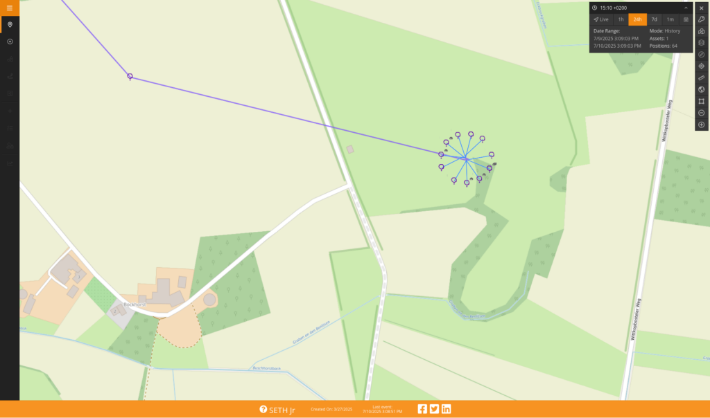
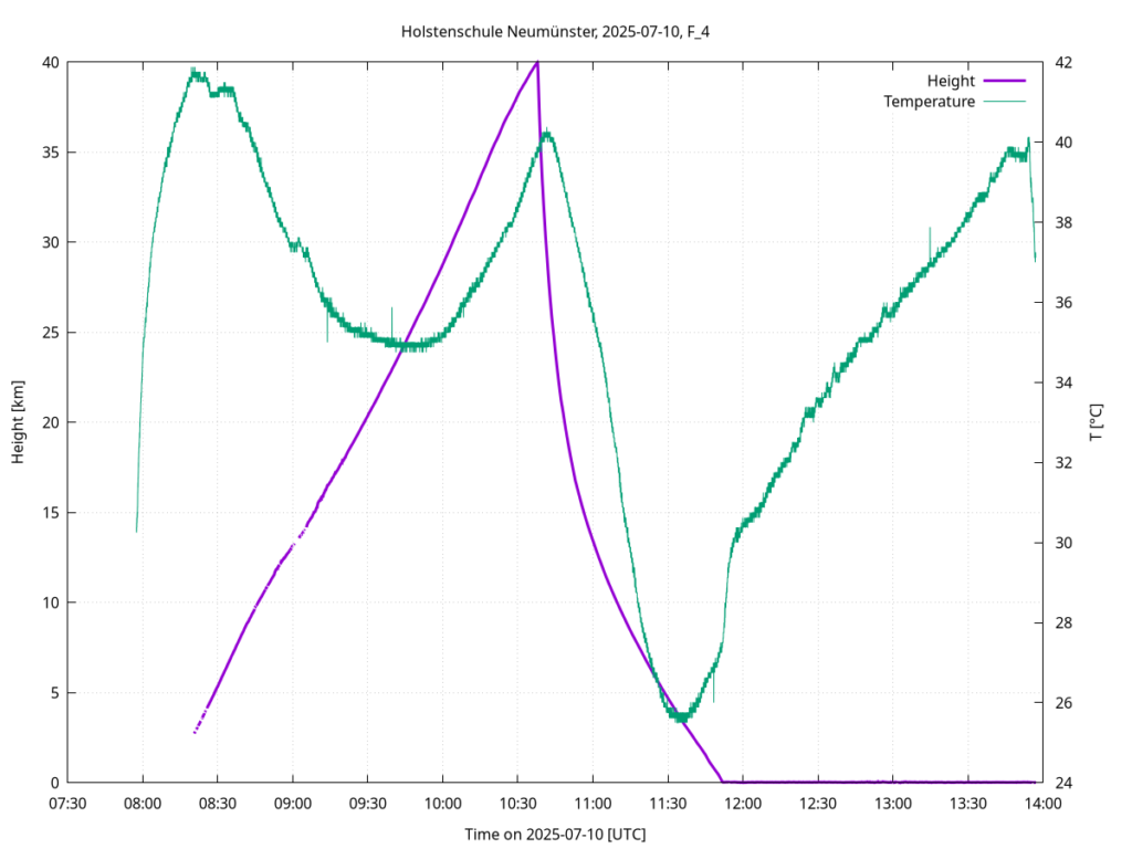
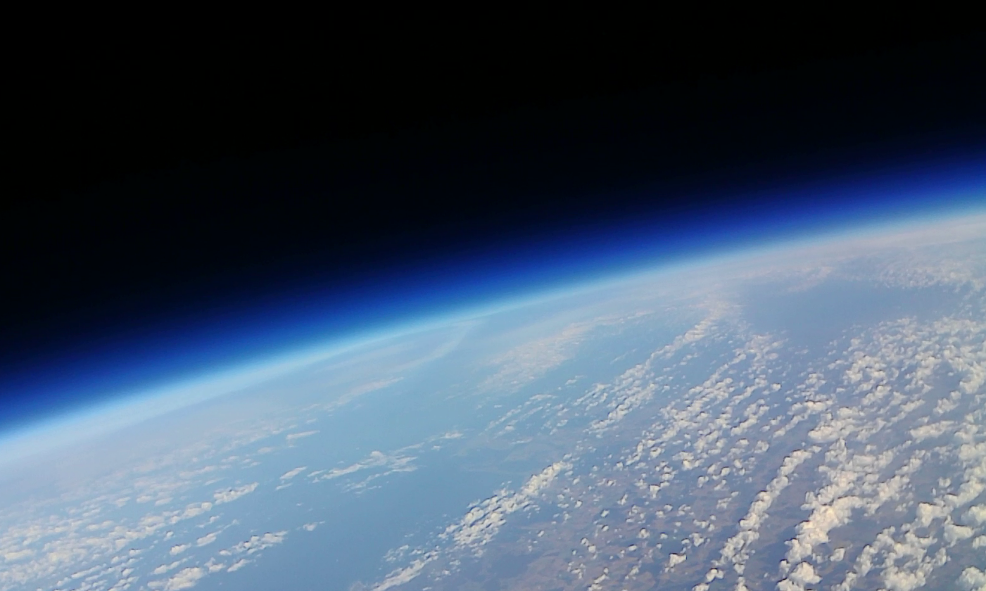
The launch was at 11o’clock on Wednesday, July 9. But where did this weatherballoon go? After the balloon burst, there were no more signals coming from the SPOT satellite radio GPS tracker.

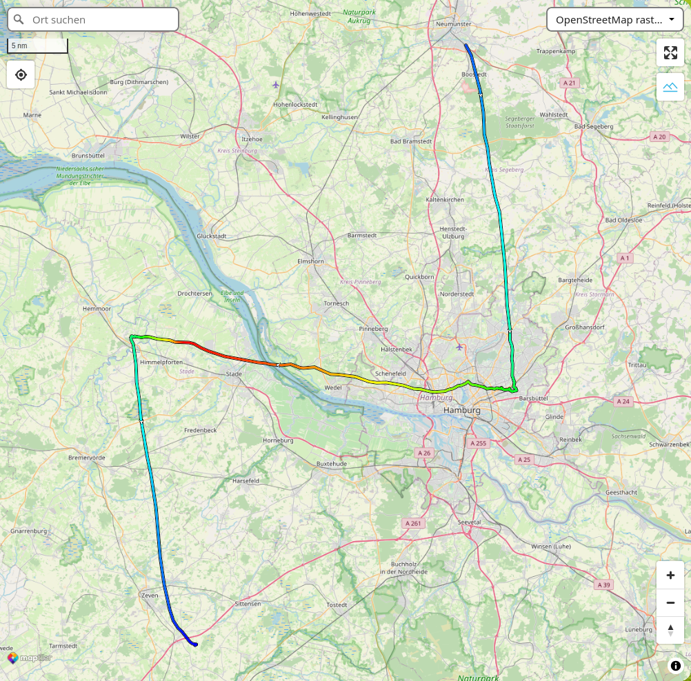
Until the the next morning (Thursday), when both GPS trackers of the probe sent coordinates, in agreement. That is the last, southernmost point of the track above. The predicted landing sites is way further south, near Munster.

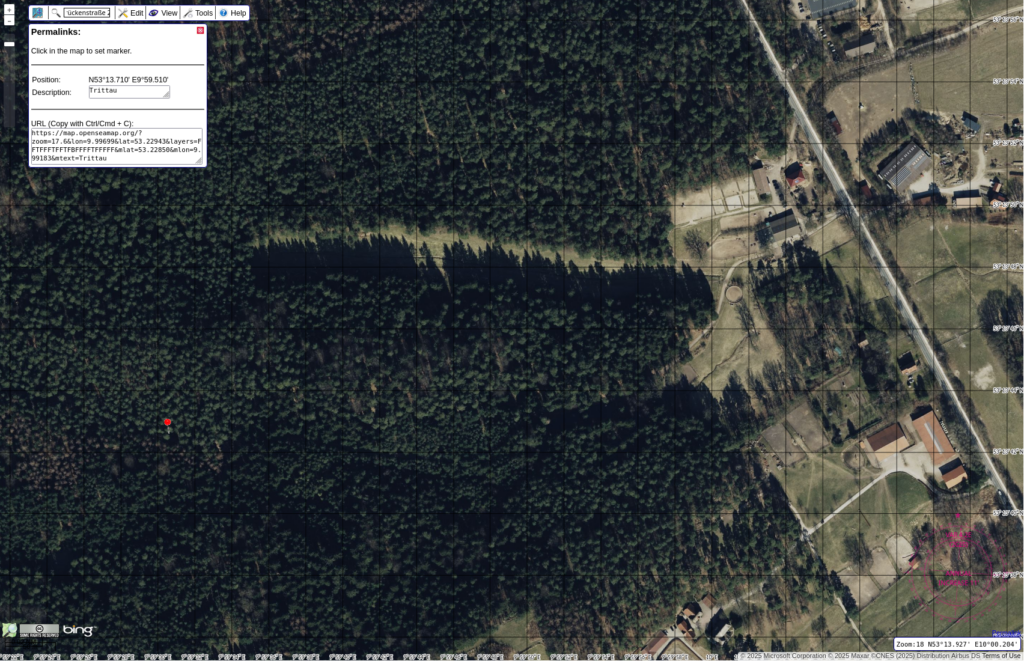
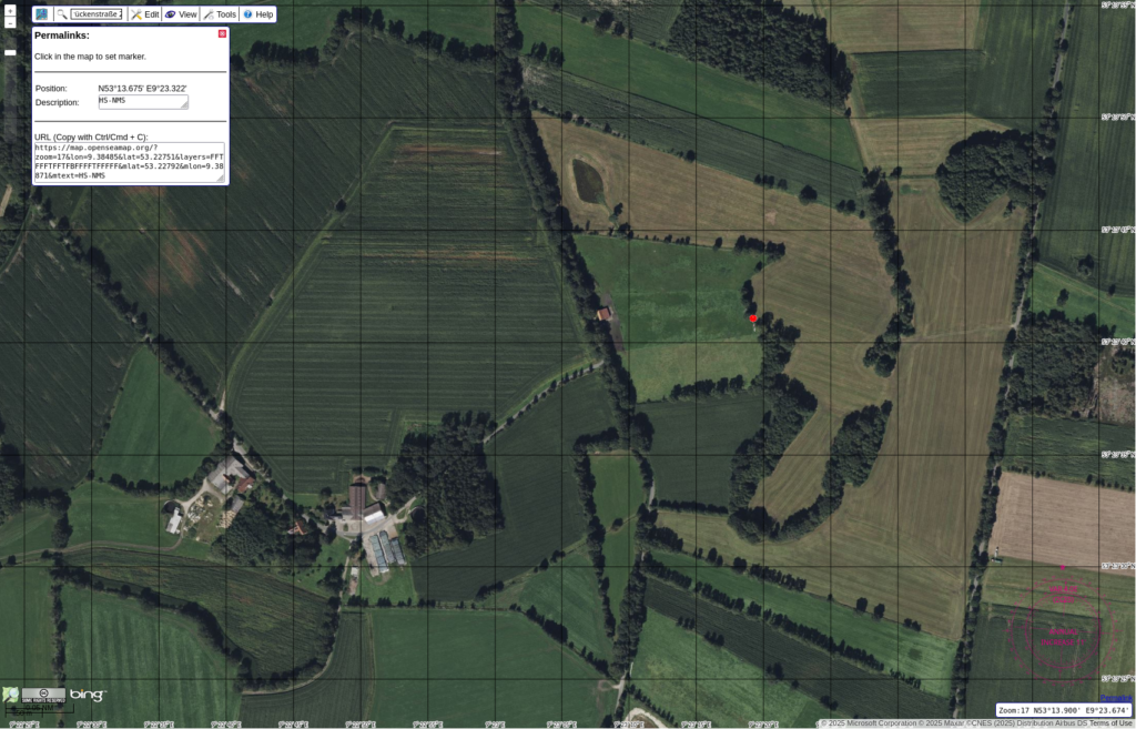
Stay tuned for the news when the young scientists from Trittau retrieve the probe from the trees near Hanstedt on Friday. The red marker in the aerial map below marks the landing site.

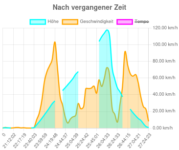
My guess: The balloon popped but did not separate from the probe. The lump of latex dragged the probe downwards like a stone. The trackers were tumbling upside down, not able to transmit to the satellite network. The probe crashed into the trees and came to rest in an unfavorable location and/or orientation.

SPOT cleared the Elbe

Our satellite radio GPS tracker again flew on a weather balloon mission. This time, it crossed the river Elbe and landed on a tree close to the highway A1. The students from Holstenschule Neumünster managed to reclain the payload. And then, the SPOT tracker got stuck in a traffic jam, on the way back north on A7 before the tunnel underneath the river.

Bottom: Flight path prediction, GPX track, color code is elevation. Top: SPOT map and Aerial of the landing site, elevation and horizontal speed versus time.

The GPS in the tracker is made for use on ground level. Above a height of 10km the algorithms were working only by chance. The elevation data in the exported GPX track is missing the most significant digits above 9999km. Those values were fixed with a text editor, for the images above.

After recovery of the probe, we analyse the data stored on SD-cards. The STRATO-MINI datalogger provides GPS, including heights up to 50km, and the temperature inside the probe.

Made in Kiel #4

Last Monday, we had the opportunity to give a talk as part of the “Made in Kiel” lecture series, organized by the Hermann Ehlers Akademie. Ava and Hannes talked about CHAOS and its journey through the BEXUS student programme. Together with Pierre, they engaged in an insightful discussion with the audience after the talk. The conversation went beyond our scientific work, touching also on the political dimensions of conducting research in today’s challenging times.

IPR-day with ZARM

Today we had two special visitors from ZARM (Center of Applied Space Technology and Microgravity) in Bremen – Dr. Merle Cornelius and Florian Leu – since it was time for our IPR (Integrational Progress Review).

Once they arrived, we quickly introduced ourselves and then headed straight to the lab. Since the ground station is finally set-up to communicate with SETH and receive data, we jumped right into a measurement with SETH – thus we demonstrated that SETH does measurements autonomously and automatic.

After that, it was time for our presentation. We talked about time management, gave a quick recap on mechanics and electronics, shared some updates on the software, and walked through our verification tests. And also: it was the debut of our outreach team (YAY!).

Next, we got some helpful feedback on our SED and discussed a few changes. Then we went back to the lab to take a closer look at the experiment (and took the photo above!). Since we had our guests with us, we also showed off our 3D printer – doing its printing – which was cool because several of our components are 3D-printed.

To wrap things up, we disassembled SETH as planned anyway. We’ve had a bit of noise in the data, so it needs fixing – nothing too dramatic, but still important.

After a full day at the University in Kiel, we said goodbye to our guests and are now looking ahead to the EAR in Bremen this September.
(But first… we have to make it through exam period. Wish us luck!)