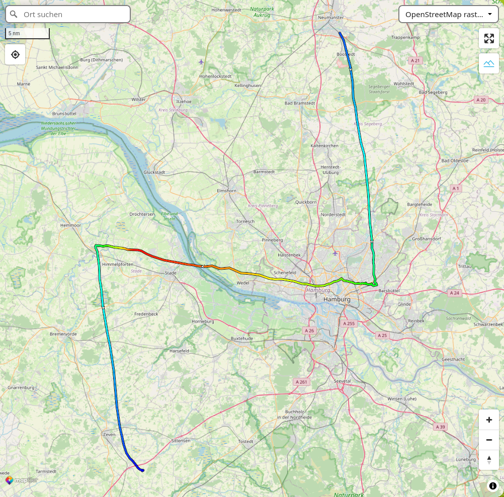
Our satellite radio GPS tracker again flew on a weather balloon mission. This time, it crossed the river Elbe and landed on a tree close to the highway A1. The students from Holstenschule Neumünster managed to reclain the payload. And then, the SPOT tracker got stuck in a traffic jam, on the way back north on A7 before the tunnel underneath the river.
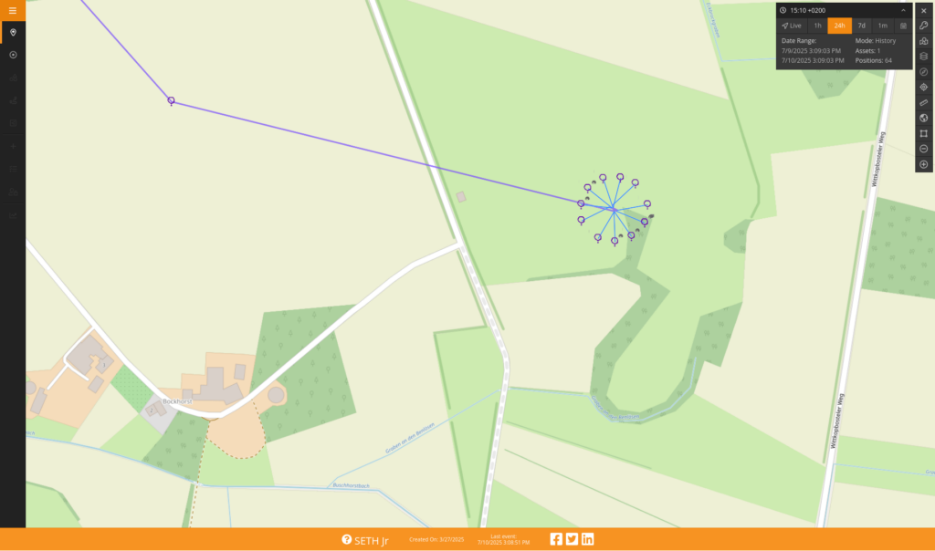
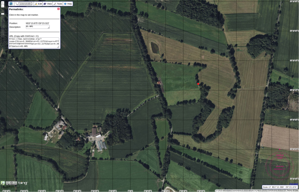
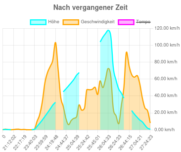
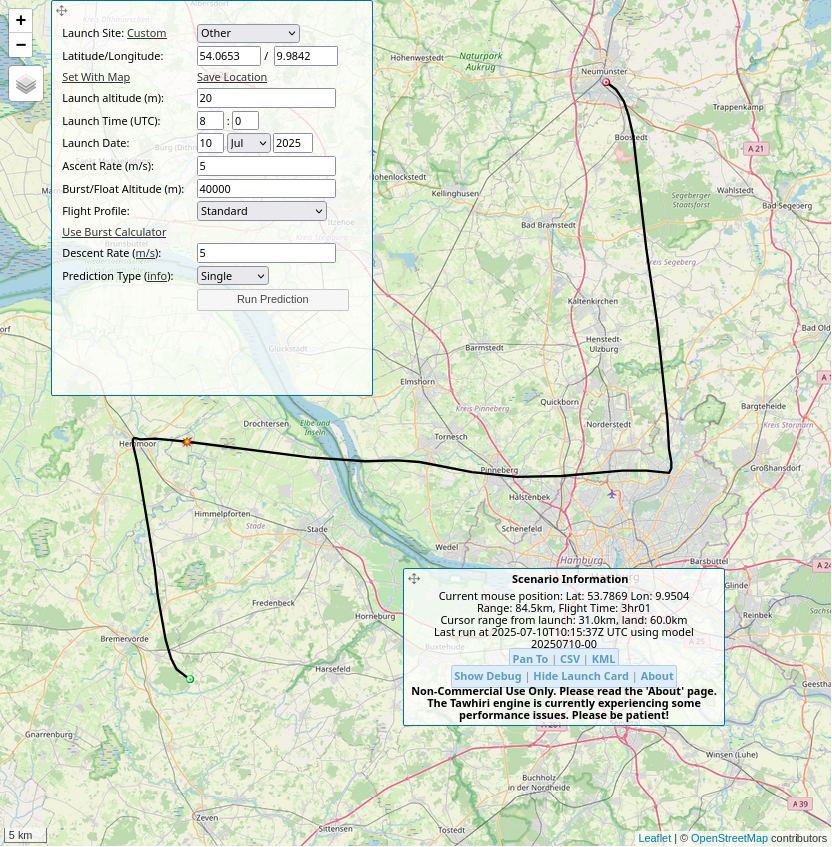
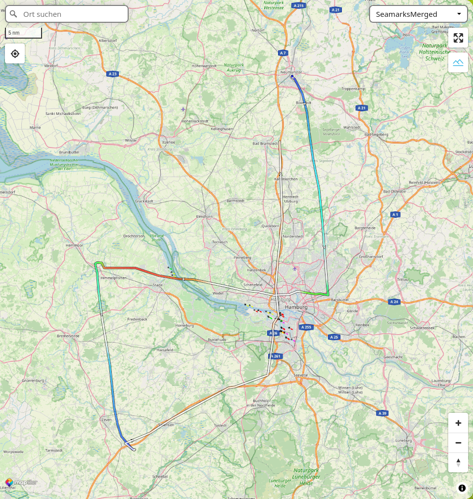
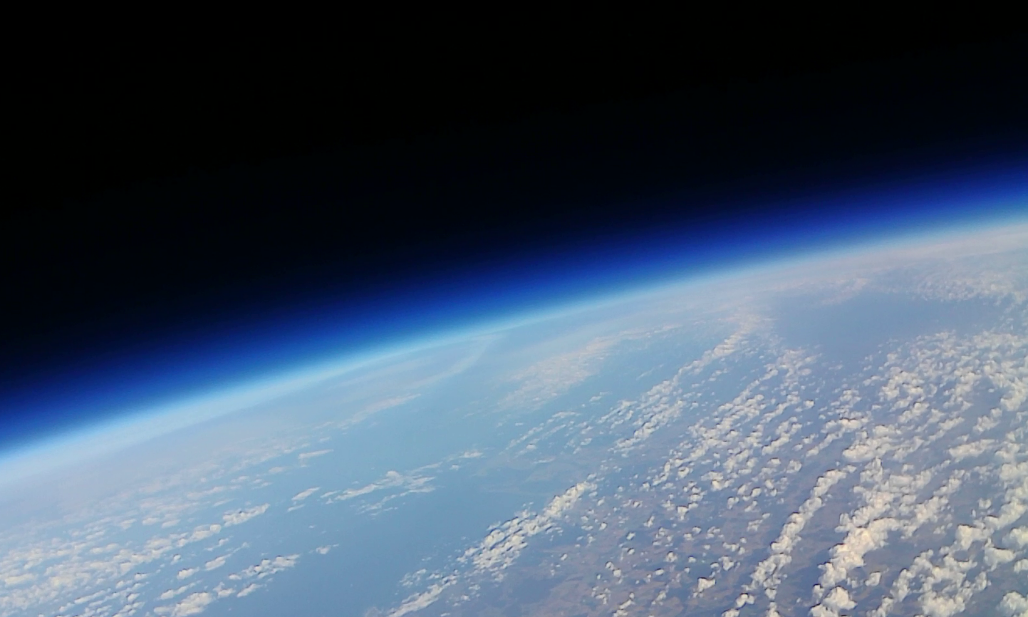
Bottom: Flight path prediction, GPX track, color code is elevation. Top: SPOT map and Aerial of the landing site, elevation and horizontal speed versus time.
The GPS in the tracker is made for use on ground level. Above a height of 10km the algorithms were working only by chance. The elevation data in the exported GPX track is missing the most significant digits above 9999km. Those values were fixed with a text editor, for the images above.
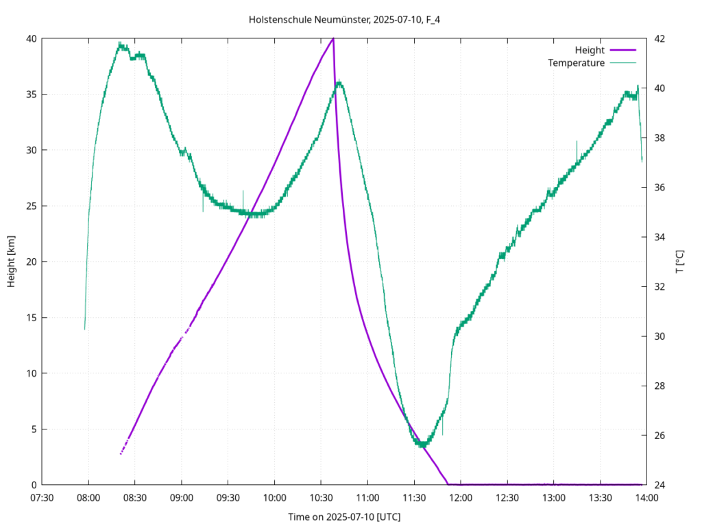
After recovery of the probe, we analyse the data stored on SD-cards. The STRATO-MINI datalogger provides GPS, including heights up to 50km, and the temperature inside the probe.